Cycling Across The Tibetan Plateau
Spring 2019

Where Lucille has been for the past 24 hours.

Sunday, June 9, 2013

Day two

Today was a huge day.  We started a bit later because of the night run last night which by the way was so much fun!!!  I tripped a few times in the dark but managed to stay on my feet.
This morning it took about an hour to shuttle all the cars where they needed to go, then we were on our bikes for leg three.  I have new respect for all my mountain biking friends!!!!  The course was long, rocky, sharp long drop offs into the smoky river, and at the same time so much fun.  I got off the bike when it got too technical, but by the end I was getting off less, riding over logs....ok maybe they were twigs but I was doing it!!!!

After a pizza lunch we loaded our bikes and headed up for leg 4, Hamel assault.  Over 6500 feet of elevation gain.  It was cool and windy at the top and lots of wide deep puddles over the entire course but my feet stayed dry for most of the leg and we only had a bit of rain....yeah!!!!  Another good day.  One more before I head home.

Saturday, June 8, 2013

Night run

It's 0022 and  just getting ready for bed.....it's been a long day.  Got up at 0500 to head to Grande Cache for the training camp, and now I just finished a short little 5K in the dark.  Good day......good night!!!

Friday, June 7, 2013

Death Race training camp

With a name like that its actually not surprising that so many people want to race it.  A few years ago someone planted the seed in my mind and this year I'm going for it.  
Grande Cache
August long week end
125 K off road race that includes 17,000 feet of elevation gain
Why you may ask....well in the words of Mallory....because it is there.
Today was the first day of the training camp, and everything is going surprising well.  We met at noon for an information session then we got our bikes ready.  I know, you're wondering why are we using bikes at a foot race?  Well, the camp is over 2 1/2 days, so to save our legs a bit we will be cycling part of legs one and three and only running 100k....which is still really crazy!!!!
After the info session, we took our bikes and viewed a bit of leg one -only about 30 minutes with one big hill.  Then it was time to get serious.  
After a short session on how to use our poles we were off to do leg two-supposedly the most difficult leg in the whole race.  It wasn't too bad but it was really muddy.  After jumping a few puddles and running around the larger ones we just resigned ourselves that our feet were going to be wet and muddy for the duration.
I ran/walked by myself for almost the entire 5 hours that it took me, but I wasn't alone....I had all of you with me.  Ted telling me to be careful, but also reminding me to enjoy myself.  Domhnall saying 'lean forward' on the steep downhills....not sure why the one is called 'bum slide' :-))).  Marco and the other Italians saying 'jump Lucille' because I'm so afraid to jump across large creeks.  All the hang glider and paraglider friends when I saw the sign that said hand gliders on the summit.  And of course everyone else who has total confidence in me, and let me know.  Thanks to you all for accompanying me on this leg, it was fun!!!  Now a bit of food and a short rest, because we are leaving at 2230 for a night run.

Monday, February 11, 2013

Team Alberta


Team Italiano


Team Nepal


Saturday, February 9, 2013

Safari

On Sunday we got up early and headed off on a real African safari!!! It was just like in the movies. We drove around with the top of the vehicle up viewing the animals through binoculars. Our guide was called Good Luck, and we were very lucky to have him as our guide. He not only drove all day, and found the animals but he but he was so good at explaining about all the different species.
It was a three hour drive to Ngorongoro crater, most of it on paved highway, and the rest was on a dirt road. On the way to the crater we stopped to view a small herd of giraffes, what majestic creatures. They stand about 5.5 meters high and the way they walk makes them appear regal. We also saw a few zebras at the same time.
When we arrived at the gates, it took about an hour to receive our permit and enter the gates. We then drove around the top of the crater before heading down to the bottom where all the animals can be found. It was here that we had some great views of so many animals. We saw elephants, baboons, wildebeest, gazelles, flamingos, buffalo, hippos, rhinos, many different birds and if course the lions. Mr. Good Luck just kept driving around on dirt trails finding all he animals for us. After almost 5 hours in the crater we were exhausted, so we drove out and headed back to the town Mto Wa Mbu. All the letters are pronounced and the words are linked together.
We spent the night in a lodge in town and had supper with Mr. Good Luck. We had such a great evening, visiting, eating and talking. We explained paragliding and we think we had him convinced to go tandem with Alan the next day!!!

Water

Along the way to the safari this morning we saw small groups of women gathered together with empty buckets. They are waiting for the water trucks to come along so that they can fill their buckets and carry them back to their families. I have no idea how long they will wait for the water, nor how far they have walked. This is why the water project sponsored by Wings of Kilimanjaro is so important and it couldn't have happened without everyone coming together in support. Thank you to everyone who has donated and a special thank you to the Good Shepard school in Peace River and the Grade 3 class of Trochu Valley School!!! You're the best!!!

Water and school project

What an incredible day we just had. I will try my best to put it into words for you....but I think that the pictures will speak louder.
The day started off like every other day.....herding cats!!!! We were told to be ready by 0930, but as it turned out many people showed up without having signed up which meant a 3 hour delay trying to get three extra vehicles. Then because it was so late we stopped for food on the way. We were hoping to be at the Masai village by noon, but we only arrived at 1530. There was grumbling and people were tired when we arrived as we had spent 2 1/2 hours on a dirt road only accessible by 4x4.
On our arrival everyone was dressed, and the men and women were singing and dancing as they walked us into the ceremony. Speeches and more singing and dancing for the next hour.
Then all the women were asked to stand in a line in front of the women entertaining us. At the end they tied a large piece if cloth around our shoulders then they gave us a piece of jewelry. When it was my turn a woman took the bracelet off her own wrist and put it onto mine.
Then it was the men's turn, they all got a different piece of fabric and a necklace.
After this we all went to see the water pump. We were told that the women would walk 10k per day to get water. This water well is serving up to 2000 people from their community. The water is then pumped into a 10,000 liter storage tank, and solar pier is used to pump the water. Then a few meters away there are three stand pipes where the woman can just turn a knob and get the water they require. As a result the women have a lot more time to do other things now that they are not spending all their time walking for water.
We then had a meal all together and hen visited the site of the school that will be built before the three hour drive home. A long day, but so worth every minute. The ceremony was an emotional time for many of us, and we had an opportunity to see and touch these humans half way across the world from us, and know that we have the same needs....to feel accepted, to do what you can for your community and also to show appreciation to others.
Its wonderful when one group can make a such a difference in the lives of another group. I was the recipient of the thanks that goes out to all of you for your generous contributions to these worthwhile projects.


Friday, February 8, 2013

Fruit stand

Having fun walking around Arusha before heading out to the Masai village.

Plant with a Purpose

I missed this charity visit as I was still on the mountain, so I do not have any pictures to show yet but I do have a bit of information.
Not only do they plant trees, but they also have some small cooperatives. These small groups get together and make small loans to locals-usually women so that they can start a business. Once the original loan has been paid off they can reapply for another. The money that is loaned out comes from people-again mostly women who pool their own money together to loan out.
Not only are they helping each other to reach their goals but they have to put a lot of time and planning into the application to be accepted. These are all life skills that can only help them improve their situation. It is really exciting!!!
Today we are heading out to a Masai village and I will post once I am back,
Yesterday we headed off to the local flying hill. Getting 30 people there was quite the feat....but we managed.
On arrival at the bottom of the hill it was hit and dusty and there was a huge dust devil. The beginnings of a thermal but it is very turbulent close to the ground. It took almost an hour to walk to the top and on arrival we heard thunder and saw rain clouds heading our way. The people who flew early hand exciting (read scary!) flights.
I spent time chatting with the locals. One young woman and I got along and she told me that all the people living below the hill are Masai - warriors. The young men dress differently once they are initiated.
Although I didn't fly and walked down I had a lot if time to visit with the young woman and she told me stories about her life and her family.

Free day!!!

We have a big day planned for today. Move out to Arusha to another hotel, tour around a bit then go flying at a hill nearby.

Back in the hotel

We are all down and off the mountain, and like every other mountain that I've climbed there is a lot to say, but I need some time to digest it before I post anything. I promise to do it soon....but right now my emotions are too strong and it is too fresh, so I thank you for your patience with me.

Summit

Here is our summit photo.....it seems so long ago now! Summit day was cool and windy. The plan was to all be up there together for a WOK group photo, but we got too cold waiting for everyone. We were at the front of the group, and after waiting about an hour on launch for others to arrive we headed down to Stella point and waited there for another few hours before we headed down to the crater camp as there were still people missing and done were only just starting to head to the summit.

Thursday, February 7, 2013

Mmmm, cold beer

I am enjoying a nice cold beer at the party after we came down on foot. Will post more in a few hours but for now just know tat everyone is safe and sound.

Lucille

Wednesday, February 6, 2013

Extreme Parawaiting

OK, so no sooner do I post my speculation, then I get a sat phone call from Lucille that pretty much confirms what I said. All but 8 have descended,about half the group has gone down half way and the rest all the way. They did get relief supplies via helicopter to the top of extra food and water so all is good there.


The eight pilots remaining are:

Lucille deBeaudrap
Marco Heltai
Alan Olivieri
Sano Babu Sunuwar
Jeff - I assume Jeffrey Brown
Arthur - I assume Arthur Fabert
Andrew Forbes
Pavel Alcocer

They are holding out for one last chance to fly early tomorrow morning...(tonight in Mountain timezone)

Lucille also wanted to sing the praises of Adrian and Paula McRae, who have been amazing in putting all of this together, and their response to the unexpected events.

She also tried to send out summit photos, but they have not arrived. Perhaps her data plan has hit the limit.....

Ted

Check-in/OK message from WoK Lucille deBeaudrap SPOT Personal Tracker

WoK Lucille deBeaudrap
Latitude:-3.09956
Longitude:37.37798
GPS location Date/Time:02/06/2013 14:28:47 NPT

Message:WoK Pilot Lucille deBeaudrap is OK

Click the link below to see where I am located.
http://fms.ws/B3xy_/3.09956S/37.37798E

If the above link does not work, try this link:
http://maps.google.com/maps?f=q&hl=en&geocode=&q=-3.09956,37.37798&ll=-3.09956,37.37798&ie=UTF8&z=12&om=1

It is now apparent that the group did not fly from the top, they must have had another day of windy or cloudy conditions.  From this check-in message we can surmise that Lucille has remained high enough on the mountain to hang on to one last chance to fly.  It seems that most of the group has descended.  If I compare Mike Spencers track to Lucille's, and they normally would travel together, where Lucille stopped, Mike was about an hour ahead of her, and he continued down.  As I write this he is nearly at the bottom.

Marco's wife Sonia posted this to facebook (translated from italian)...

"to high camp were officially 8. tomorrow if the weather will allow him attempt the flight. wings Verona considering the adverse conditions will fly in tandem"

From this I am going to conclude that Lucille, Marco, and Alan are among 8 pilots who have remained high on the mountain for a chance to fly.  It's not over until they get to the bottom.  Alan has a Tandem glider and he will need a passenger to fly.  If his intended passenger descended on foot, then either Lucille or Marco will have to be his passenger.  Sonia says "wings Verona...will fly in tandem".  I interpret that as the Verona Pilots (Marco and Alan) will fly tandem, and Lucille will fly solo.

Just remember, I am getting all this from one check-in message, a track-log on a second spot, and a translated snippet of Italian.  I've been wrong before.

I now wish that I had accompanied Lucille on this trip, and voluteered to be the social media person on the ground to keep the rest of the world informed.  I have found the lack of updates from official Wings of Kilimanjaro sources dissappointing.  I think they could have used a few more non-participating volunteers to help with communications.

Ted

Tuesday, February 5, 2013

Parawaiting


It has now gotten late enough in the day that everyone would be tucked in and waiting for more calm conditions in the morning.  Cross your fingers.

The image below is a screen shot from Google Earth showing the relative positioning of the 7 camps, the summit, and the designated landing zone.  The straight line distance from summit to LZ is just over 19km.

Ted


Some troubles on the mountain.

Well with a subject line like that I should first say that everyone is OK and for you not to worry.

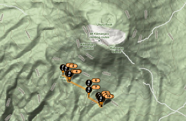
Everyone is wondering, no doubt, about flight status and why it appears some have gone and others not. Well first of all, it was way too windy to fly, so the popular sport of Parawaiting has emerged, even at 19,500 feet. They plan to wait it out one more day for a potential to fly down.

However, there has been some kind of misunderstanding among the guides and porters and some tempers flared. I would be concerned too if I hadn't been paid yet for my work and your customer is about to fly the coup. In the local economy, there isn't the same level of trust and protection as elsewhere.

So, hired by the guiding company there are a number of guides and a large number of porters hired for this trip numbering close to 600 in total. Apparently the misunderstanding has escalated to the point where ten guides have withdrawn their services, and convinced 100 porters to follow their example. To make matters more challenging is that this group has descended a ways, and are blockading the passage of water up to the group, so where everyone should be drinking three litres a day, they have only had access to one litre this past day.

There has been a helicopter drop arranged to get them more water, but long story short, they will have to either fly off or start their descent in the next day, so the flight may not see safe wind conditions in time.

Lets hope that cooler heads prevail and this misunderstanding gets resolved. The participants also have to put their personal gear at risk when they fly off the mountain and are trusting that they will see it all again at the bottom.

Through all of this some participants have already started to descend, mostly those that were not feeling that great up at 20,000 feet. Our intrepid group of Lucille, Mike, Marco, Alan, and Bob are doing well and perfecting their Parawaiting form and technique.

Ted

Monday, February 4, 2013

Feb 5 voicemail


VoiceMessage


Click above to listen to Lucille's voicemail from Feb 4. The summary would be that she is at camp 7 on the glacier in the crater below the summit. They are waiting to assess the wind conditions in the morning and may need to wait another day. Cross your fingers for favorable conditions to fly. Ted

Check-in/OK message from WoK Lucille deBeaudrap SPOT Personal Tracker

WoK Lucille deBeaudrap
Latitude:-3.07306
Longitude:37.35188
GPS location Date/Time:02/04/2013 19:02:51 NPT

Message:WoK Pilot Lucille deBeaudrap is OK

Click the link below to see where I am located.
http://fms.ws/B2qGu/3.07306S/37.35188E

If the above link does not work, try this link:
http://maps.google.com/maps?f=q&hl=en&geocode=&q=-3.07306,37.35188&ll=-3.07306,37.35188&ie=UTF8&z=12&om=1


Summit Day

Jumbo everyone. Five o'clock came fast this morning. My tent wasn't level so I spent all night rolling around, usually sleeping on the hard ground!!! No worries the night is over. We were told breakfast would be at 0600, and leaving at 0700. Breakfast doesn't seem to be ready however....so a seven o'clock departure seems unlikely.
The plan is to summit today, then sleep in the crater just below the summit. Tomorrow morning we will be getting up early again and doing a 200meter walk (horizontal) to the launch area and fingers crossed.....fly off to the warmth!!!
We are all very excited.
Lucille

Sent from my iPhone4S

Check-in/OK message from WoK Lucille deBeaudrap SPOT Personal Tracker

WoK Lucille deBeaudrap
Latitude:-3.07649
Longitude:37.35410
GPS location Date/Time:02/04/2013 15:19:52 NPT

Message:WoK Pilot Lucille deBeaudrap is OK

Click the link below to see where I am located.
http://fms.ws/B2m62/3.07649S/37.35410E

If the above link does not work, try this link:
http://maps.google.com/maps?f=q&hl=en&geocode=&q=-3.07649,37.35410&ll=-3.07649,37.35410&ie=UTF8&z=12&om=1

WoK Lucille deBeaudrap

You have received this message because WoK Lucille deBeaudrap has added you to their SPOT contact list.

Every day is an Adventure. Share Yours.
http://www.findmespot.com

Sunday, February 3, 2013

Feb 3 - -Voicemail


VoiceMessage


Click above to listen to Lucille's voicemail from Feb 3.

The summary would be that she is at camp 6, 4,800 m. Tomorrow is summit day, and early on the next morning, weather

permitting, they will fly down. Correcting for the timezone difference, watch the spots Monday evening from as early as 8:00 PM Mountain time.

Ted

Feb 3


Just one more day to the summit, and then the next day, weather permitting, the flight down is planned.

Here are the usual spot and Google Earth captures of Lucille's activity overnight.  I am assuming she is saving whatever battery life remains in her iPhone for the summit or for just before her flight.  Stay tuned for more.

Ted


Saturday, February 2, 2013

Camp 5


We had a great day today. After breakfast we got together in groups and I was lucky enough to be in the group that was being serenaded up the hill. Someone brought his small guitar and was playing while he was walking. There is always a lot if singing and chatter. I thought that I would hate being part of a group so large, but it's actually a lot if fun!!!

Today after the steep hill there was a bit of down then up and down again. Four very slow hours with lots of stopping. Still have lots of people who are not feeling well. Marco and Alan, Mike, Bob and myself are all doing well. We often travel together in a group.

We are all getting excited. Two more days before the summit!!!! Yeah! This is a seven day trek to the summit to give everyone the best chance of making it up. Fingers crossed that we all make it.

This morning would have been a perfect day to launch and fly. What we need are light winds in the right direction....blowing up launch. We are hoping for some wind as we will have to run very hard and fast if there isn't any wind....difficult to do at 19,300 feet or 5900meters!!!!! Our landing zone is at 5000 feet or 1300meters and it is a huge field located 29.7 km away. We would have to try really hard to miss it.

The one thing that has us concerned is the cloud layer......we certainly don't want to be running into each other up there. It usually starts building at around 9am and within 30 minutes we are unable to see the landing zone because if the clouds.

My iPhone battery is getting low and my charging system isn't keeping up so I may not be able to get out another message and if not....keep your fingers crossed on Tuesday night at around 9pm!!!! Watch the SPOTS!!!!!

I will give more details about the charities once we land and I get to visit them....but it's not to late to donate if you wish. None of the money is going to the government....it is going directly to the charities....drilling water wells, building two schools and planting trees.

Bye from everyone here, and thanks for following!!!!
Marco, Alan, Bob, Mike and me....Lucille!!!

Check-in/OK message from WoK Lucille deBeaudrap SPOT Personal Tracker

WoK Lucille deBeaudrap
Latitude:-3.11272
Longitude:37.35452
GPS location Date/Time:02/02/2013 16:12:03 NPT

Message:WoK Pilot Lucille deBeaudrap is OK

Click the link below to see where I am located.
http://fms.ws/B1gP6/3.11272S/37.35452E

If the above link does not work, try this link:
http://maps.google.com/maps?f=q&hl=en&geocode=&q=-3.11272,37.35452&ll=-3.11272,37.35452&ie=UTF8&z=12&om=1


Friday, February 1, 2013

Jambo from Kilimanjaro


The start of a new day. Just four more days till we fly down to th LZ pictured here.


February 1

Jumbo everyone.

Today we headed off after breakfast, around 0830 and headed up. We had the option of heading straight to Barranco camp, or detour to the tower which is what we did then climbed to the top of the tower. Fun. A bit if bouldering. Then we kept going up to arrow glacier. A long day but we are all feeling good!

Mike is just as crazy as ever...Marco and Alan are doing well, and so is Bob. We are taking lots of photos of the group....so big!!!

My young porters are very nice and working hard. We have also met many guides...all very nice. The food is not spectacular....but it is filling us up.

Mike told Marco that they were going to have a cricket match on the summit. Marco didn't understand so Mike said yes, they draw a big circle, and take the little crickets and put them on the outside and the race is to see who makes it to the middle first!!!!! Marco believed him. Several hours later Marco asked me what mike had said!!!!

Today, although we are above the tree line we did see some beautiful flowers, some green shrubs and a waterfall. So much to see here. There are many different routes up this volcano. I thought that it would be all dry and dusty but actually we have seen a lot of lush areas. We have had rain every day...yesterday only at night.

There are some big clouds building and Marco says if the rain comes then tonight we will go kayaking!!!

Mad Mike Kung had a few flights yesterday and another one today. There is a reason his name starts with Mad!!!

And finally, a shout out to the grade three class at Trochu Valley School and the grade six class at the Good Shepard in Peace River. Both these classrooms were special contributors to my fundraising and I am thinking of you every day.

Lucille

Check-in/OK message from WoK Lucille deBeaudrap SPOT Personal Tracker

WoK Lucille deBeaudrap
Latitude:-3.09502
Longitude:37.33075
GPS location Date/Time:02/01/2013 21:49:09 NPT

Message:WoK Pilot Lucille deBeaudrap is OK

Click the link below to see where I am located.
http://fms.ws/B1Dwb/3.09502S/37.33075E

If the above link does not work, try this link:
http://maps.google.com/maps?f=q&hl=en&geocode=&q=-3.09502,37.33075&ll=-3.09502,37.33075&ie=UTF8&z=12&om=1


Thursday, January 31, 2013

Check-in/OK message from WoK Lucille deBeaudrap SPOT Personal Tracker

WoK Lucille deBeaudrap
Latitude:-3.04262
Longitude:37.29983
GPS location Date/Time:01/31/2013 15:13:40 NPT

Message:WoK Pilot Lucille deBeaudrap is OK

Click the link below to see where I am located.
http://fms.ws/B0X56/3.04262S/37.29983E

If the above link does not work, try this link:
http://maps.google.com/maps?f=q&hl=en&geocode=&q=-3.04262,37.29983&ll=-3.04262,37.29983&ie=UTF8&z=12&om=1

The group has advanced to nearly 4200m at the Moir camp.


Here is the full Itinerary if they stay on Schedule.

January 29 – Machame Gate, 1790m. Walk to Machame Camp, 3010m

January 30 – Walk to New Shira Camp, 3845m. Those of us feeling fit will walk around the Shira Plateau and summit the Shira Cathedral in the afternoon and then walk back to the New Shira in time for dinner.

January 31 – Walk along the edge of the Shira Plateau and setup at Moir Camp, 4175m.

February 1 – Walk South East for Lava Tower 4640m and stop here for lunch. Those people feeling fit and not too affected by the altitude will then climb another vertical 190m to Arrow Glacier, 4830m (and just higher than Mt Blanc!). Here we are at the foot of the Western Breach Route to the summit. We will then head back down to Barranco Camp, 3960m, joining the other lazy buggers who went straight downhill from Lava Tower. This walk takes us through what our team christened the Garden of Eden (Original huh?) and is one of the coolest days on the walk! Spectacular!

February 2 – Begin to turn East and climb the steep gorge out of Barranco and cross over into the Karanga Valley making camp at Karanga, 4035m.

February 3 – The climb begins to start heading North east and skyward, passing through Barrafu Camp at 4640m and setting up at high camp above Barrafu at around 4900m. 1 more day to go!

February 4 – Summit Day! Monday 4th of February 2013 is the day that the biggest group ever to summit Kilimanjaro begins to head North West to Stella Point, 5730m and continues onto Uhuru, 5895m for the biggest group photo (maybe ever??) on any one of the 7 summits! From Uhuru, we will walk down the crater to find a got dinner and tents ready for sleeping at Crater Camp, also at 5730m. Those feeling fit will explore the many glaciers at Kilimanjaro and also walk to the Reusch Crater, Kilimanjaro’s still active volcano shute.

February 5 – Something about getting off the mountain in a hurry.. James Bond Style!

Ted

Wednesday, January 30, 2013

Check-in/OK message from WoK Lucille deBeaudrap SPOT Personal Tracker

WoK Lucille deBeaudrap
Latitude:-3.06717
Longitude:37.27655
GPS location Date/Time:01/30/2013 19:38:29 NPT

Message:WoK Pilot Lucille deBeaudrap is OK

Click the link below to see where I am located.
http://fms.ws/B02gs/3.06717S/37.27655E

If the above link does not work, try this link:
http://maps.google.com/maps?f=q&hl=en&geocode=&q=-3.06717,37.27655&ll=-3.06717,37.27655&ie=UTF8&z=12&om=1

Today the group moved up another 850m to the 3,850m mark.  Lucille phoned, and indicated that the last two days have been rainy, and it was raining when she went to bed.  It is the end of the short rainy season there, and they hope for improving conditions going forward.

Ted


Tuesday, January 29, 2013

January 29

Well after one day on the mountain it appears that the group has made it to Machame camp at 3,000m.  The spots have not sent out many messages, perhaps they had some trouble figuring out where in the world Waldo is, and had to work extra hard to find themselves.  They may have also been placed a little too deep in the backpacks.  Anyways, although Lucille's spot only sent one track message, I actually have visibility to five spots.  Lucilles, her two friends from Italy Marco and Alan, and her two friends from Alberta Mike and Bob.  Today, Alan's spot got the most detail through.


Here is what it looks like in Google Earth showing their position on the mountain.


Still a little ways to go.  No voice messages today.

Ted

Monday, January 28, 2013

This is a photo with Babu Sherpa. He flew tandem off the summit of Everest in 2011!!! I had the pleasure of sitting next to him at lunch yesterday. We had a bit if a chat about Nepal.

Day one!!!

Getting ready to go

Paragliding

A paraglider is actually a wing. It is made a special rip stop nylon type fabric. There is a top and a bottom. There are rows of lines - strings that keep the shape of the airfoil when we are flying. The lines all come together and attach to the harness that we sit in.
There are many many different gliders. First of all there are many different companies that make paragliders. Each company makes different classes of gliders from a beginner glider to an advanced and competition glider. The difference is like the difference between a station wagon and a sports car. A station wagon or beginner glider is generally easier to launch, goes slower and is vertually indestructible....meaning that it can only be flown when the wind is not too strong and that it can recover from any collapses without pilot input. There are usually about four levels. I fly a glider somewhere in the middle. Along with the different types of gliders they also come in 3-4 different sizes. Most companies also make a tandem glider, a larger glider that can take two people at the same time.
Then there is the harness, the part that we sit in and it is attached to the paraglider in such a way that we are suspended underneath it. There are many different types of harnesses that also come in different sizes. We all fly with a reserve parachute, that we can deploy if we have problems with our paraglider. We attach all our instruments to the harness or to ourselves. Pilots will fly with a varying amount of electronic devices.
First almost all pilots fly with some type a variometer. This device tells us our altitude but more importantly it tells us when we are going up and how quickly as well as telling us when we are going down and again how quickly that is happening. We get a visual as well as an audible signal that tells us this information. Most of us also fly with a GPS which we use to tell us our ground speed and our location, and more importantly so that we can tell our retrieve driver where to pick us up, this is done with a ham radio. Some also carry a SPOT so that we can not only be tracked but if we go down and we are unable to use our radio, then we can send a help message out.
The whole purpose of paragliding is free fight. We can walk or hike to a launch site, open it up and run off the hill until we are flying. We have two brake lines which is what we use to turn, by slowing down one side and moving our weight by leaning over we turn. The magic happens when we can stay in lifting or rising air by turning, thus going up. The challenge is to stay in this rising air, gain elevation then to fly to the next thermal or rising air and turn in that one and to keep on going. The current paragliding record is over 500 km!!! Amazing.
When I was a new paraglider pilot many years ago a female paraglider pilot came to South Africa and set the new open distance record. At that time it was well over 300km!!!!
This in a nutshell is paragliding....the technical part at least. The feeling is difficult to describe. The poem by Rene that I posted a few days ago will give you a bit of an idea. I will try to explain over the next few days.

Team Italiano

Alan Olivieri, Marco Heltai with pseudo Italians me and Mike!!!

Team Alberta

Mike Spencer, Lucille deBeaudrap and Bob Gardner.

We flew!!!!

Today we had a great flight from a small local hill.
Let me try to explain what happened today as it is typical....here...in Canada.....in Italy....etc. we got up had breakfast and a press conference. Then we hear some rumblings....some of the pilots were going to fly...whisperings...are you going, is there room, where are we going, what are the conditions like, do we have to hike, what is launch like? Well the problem is that there were more paraglider pilots than there were seats in the vehicles. Waiting and milling around....chatting for over an hour. Then someone made the decision. Two taxis and two 4x4's to get us into Urushu. The taxis arrived and then we decided to eat. Trying to round up 35 people to all go to the same restaurant....order, eat then pay!!! It's like herding cats!!!
Then we all load up into 5 land rovers and head off to launch, but not until we had a 45 minute stop at the grocery store. Our drivers didn't know the way so we stopped to call the others who were ahead of us. Another 30 minute delay. Finally we got to the hill about an hour before dark....with about a 1000' hill to climb to get to launch. There was only one person whining and she stayed behind while the rest if us headed up, anxious for a flight.
We got up and the wind was strong. I was thinking of heading down, but after about 20 minutes it backed off a bit, so I set up and launched. There were about 20 pilots in the air....all having a great time. I had about 15 minutes in some magic air.....so worth having spent almost all day for it.
The locals at a nearby village came out and hiked up with us, watched us fly and greeted us at the landing zone. We collected some money to give them which was very appreciated.
In about 5 hours I will be getting up and getting ready to leave by 7am. I have a SIM card so I am hoping that I will be able to blog while in the mountain....at least part way up. Yeah!!!

Sunday, January 27, 2013

Day 0

Tomorrow is the day that we start our big adventure and the excitement is building. Everyone has arrived and preparations are ongoing for tomorrow morning.
I wanted to show a picture of my room....ultimate luxury compared to what I'm used to. You'll notice that there is mosquito net around the bed which is there for more than just looks. Some Mosquitos here carry the organism that causes malaria in animals and humans. This can be quite nasty with mild to moderate symptoms but about 2% of people that are infected.  This doesn't sound like a lot but over 216 million people are infected annually and up to 1.2 million will die....most are children. The best treatment is prevention...so long pants and sleeves, mosquito repellant and then we are also taking pills daily.


Day -1!!

We are two days from setting off....so that's why I called today -1!!!
We arrived at the airport and were treated by Adrian...he and his sister are the ones who started all of  this. Great to finally meet him in person.
On the drive in from the airport to the hotel he filled me in on some of the details about the project. The charities that have been selected, we selected because of their low overhead. Actually all the money is going to great projects that will be long lasting. Many millions of dollars has been poured into Africa over the years and there is very little left to show for all that money.
We are partnering up with the government, once the two schools are built then they will be turned over to the government to supply the teachers etc. the water wells and the trees will be lasting, and will still be here in 50 years. Visiting the charities will occur after the flight and I think will be the highlight if the trip.
We also had a two hour pilot briefing meeting while a bit long gave us a venue to meet each other and to start to connect. We discussed about the climb, the physicians talked about how to stay healthy and we hit some insight about how we are going to get a village up the mountain. We are 100 pilots with 6 Porters each. Four are group porters that will carry up tents, water and food along with a toilet. We each have two porters, one for our paraglider and one for our personal gear. With camera crew etc we are over 750 people going up!!! A village!!!
We just had a great supper and now we are watching Babu Sherpa give a presentation of him climbing to the summit of Everest then paragliding off. Exciting!!!
Now it's off to bed!!

Arrived!!!!

We have arrived!!!!

On our way

We are currently in transit, with a short layover in Ethiopia. This is our first time in Africa and what we noticed coming into land in Ethiopia is the landscape. Everything is brown.....we have seen only a few trees and very little great in the form of plant life. We saw one water source, small and brown without any green around it.
The other thing we noticed was the lack of roads. No roads leading to the city, and once we were flying over the city the roads just ended.
We have another two hour flight and then we will have arrived at our destination, Kilimanjaro airport.

Friday, January 25, 2013

Last day in Italy

This is my last day in Italy, and I have received some questions about my week here, so here is a bit more information about what I have noticed here.
First of all, the biggest thing that I have to get used to is to remember to ask for 'no gas' when I order water. It's just not the same when it's carbonated! It almost has a bitter flavor.
Secondly coffee is served in small cup and usually drunk while standing up at the counter. Certainly no Starbucks venti size here....nor any double double!!!
As for both snow and green grass at the same time....in the valley here there is grass year round....flowers are growing, but it is still winter. The grape vines in the vineyards are bare, all the leaves are off the trees, and they did have a bit of snow a few days ago, but it has melted. We are at the base of the mountain so when we go high enough up the mountain there is snow.
As for the pasta, most of it is fresh, not dried like it is back home. Everything tastes better because many of the fruits and vegetables are grown locally, left to ripen before being harvested and only has to travel a short distance from producer to consumer.
And a greeting for a friend is ciao and it means both hello and goodbye. It is usually repeated many times.....ciaoCiaoCiao, Ciao!
So Ciao and arrivederci!!! A domani (tomorrow)!!!

Check-in/OK message from WoK Lucille deBeaudrap SPOT Personal Tracker

WoK Lucille deBeaudrap
Latitude:45.61252
Longitude:10.74763
GPS location Date/Time:01/25/2013 17:21:12 NPT

Message:WoK Pilot Lucille deBeaudrap is OK

Click the link below to see where I am located.
http://fms.ws/AzKzg/45.61252N/10.74763E

If the above link does not work, try this link:
http://maps.google.com/maps?f=q&hl=en&geocode=&q=45.61252,10.74763&ll=45.61252,10.74763&ie=UTF8&z=12&om=1

WoK Lucille deBeaudrap

You have received this message because WoK Lucille deBeaudrap has added you to their SPOT contact list.

Every day is an Adventure. Share Yours.
http://www.findmespot.com

Thursday, January 24, 2013

Visiting friends

Tonight was special. We went to visit Walter in his home and shared a delightful meal with them. Walter was on Manaslu this summer as part of the Italian team that shared out base camp. Although I am about to start a new expedition, and all my energy is focused on it, I couldn't pass up the opportunity to relive a bit of a past expedition.
We looked at pictures and videos, told stories and just shared the experience we had......together but separately this spring.
Supper was unbelievable....an assortment of munchies, olives pickled onions on the table. The appetizer was two large blows of Russian salad, deviled eggs along with cheese and salami. The first course was two large spinach cannelloni, then a huge salmon filet with roasted potatoes....then out comes a roast. Just when I thought I was going to burst a delicious salad. Then we needed desert....one not three!!! Fruit salad, then strudel and then a large bowl of pastries. Unbelievable!!! I may not have to eat for a week!!! :-)))
It was not possible to fly today so I packed and organized and relaxed. A great day!!!

More training flights.

This is a video Marco put together from our flight yesterday. All the video is from his GoPro because I was having technical difficulties with mine.....er...the operator of said GoPros!!! He had a GoPro mounted on the end of a stick and had it facing him for most of the flight, but he did drop it under him for an interesting view.

I think I have it all figured out now as I may not have another opportunity for any more test flights before heading to Tanzania. The batteries are charged, correct memory cards are inserted, lanyards are attached so I don't lose them and the charging cords and solar charging panel are packed. I think I'm ready!!!

My plan is to mount one on my helmet looking forward, mount one on the back of my harness looking behind me. This will give an interesting view of the mountain as I'm flying away, as well has having frontal views of the pilots behind me. The third I will place on my ankle looking back at me and my wing. I am not sure if I will fly with the one attached to the pop bottle.....it is designed to fly behind me to catch a view of me and where I am going. Yesterday I hung it too low and it did a bit of bouncing while I was running to take off, and there wasn't a view of me. If I hang it too high, there is the possibility that it could get caught in my paraglider lines, which wouldn't be very good. If I get to fly tomorrow then I will try it out again.

Enjoy the video!!!

Click here

Wednesday, January 23, 2013

Training flight

The plan for today was to get up early, hike up to the refuge and launch from there but Mother Nature had another plan for us. The wind was in the wrong direction for that launch so we went to a different spot....one that did not require any hiking :-(
Actually today was a typical Canadian paragliding day where the biggest adventure was getting to the launch....driving through deep snow...almost getting stuck was way more exciting than the flight....almost.
Today I put on two GoPros, one on my leg looking up at me and one attached to a plastic bottle flying below and behind me. Well...I forgot to put a memory card into the one on my foot, and the one flying behind me I put in a memory card that is too slow....so the video is choppy. But the flight was great! Four crazy Italians and me...thank goodness for the little bit of Italian that I learned prior to getting here.
Below us a picture of the GoPros that I plan to fly with tomorrow. One on my ankle, one on my helmet, one on my harness looking backwards and one flying behind me. They are charging right now, and they all have the appropriate memory cards in them. I'm prepared....now we just need the right wind conditions to fly!!!!
:-)))))


Training.....Italian style

This morning we got up early....hoping to go paragliding, not only for the enjoyment of the flight but also to try out the placement of our GoPros. The wind was much too strong so we made a little stop here!

Tuesday, January 22, 2013

Why I love paragliding

My friend from Italy, Rene, wrote a poem in Italian about paragliding. I wasn't able to read it so I put it through google translate....not expecting much, and this is what came out.
For those of you who paraglide I'm sure you can feel it in your whole body, and for those who don't, this should give you a little taste of why we like it so much.
Enjoy.

A step ... a breath
and I'm in the wind,
around me, the silence
and under ...

nature flowing.

I look up
open, as if to envelop
elegant and beautiful,
I admire with joy
she is ... my sail.

My arms open to the sky
and that feeling of peace,
all under my feet
master of myself.

A music without notes
only that of the wind,
I'm happy because today ...
I kissed the clouds,
I ... son of the wind.

More training....or am I just having fun??

Well, maybe a little of both. Last night I was told that Alan another WOK participant was going to pick me up at 0900 and that we were going up to the refuge...a hut on the top of Monte Baldo. Alan doesn't speak much English and although I can say yes, no, please and thank you in Italiano....it doesn't go very far in getting details about what is going to happen.
This morning we drove up a road for about 20 minutes then we stopped and met up with his friend who had a snow machine on a trailer. I went ahead and headed up the path, thankfully a few people with snow shoes were ahead of me breaking trail, otherwise I would have been half way to my knees!
Alan and his friend were going up to the refuge to help out the elderly couple that live there. The refuge is a hut where this couple serves food and drinks, and I think people can also stay there. Alan and a few others go up there to clear the snow, bring them what they need from town and bring down their garbage.
I hiked up for about 90 minutes, all the while it was snowing. It was getting deeper and deeper almost up to my knees, and I was wishing for my skis or even snow shoes, when the boys showed up on mono ski machines. I got on and got a ride for that last little bit to the refuge.
As we were warming up in the refuge and I'm trying to have a bit of conversation, a couple shows up. As it turns out they are also headed to Kilimanjaro, just a few days after us! They were very excited when they found out that we have a whole group that plans to paraglide off the summit.
So in the end I had a lovely hike, ate some fantastic spaghetti in the refuge, met some nice people oh and enjoyed some snow and sunshine. A perfect training day!!!


Check-in/OK message from WoK Lucille deBeaudrap SPOT Personal Tracker

WoK Lucille deBeaudrap
Latitude:45.65289
Longitude:10.78993
GPS location Date/Time:01/22/2013 19:52:10 NPT

Message:WoK Pilot Lucille deBeaudrap is OK

Click the link below to see where I am located.
http://fms.ws/AxhHX/45.65289N/10.78993E

If the above link does not work, try this link:
http://maps.google.com/maps?f=q&hl=en&geocode=&q=45.65289,10.78993&ll=45.65289,10.78993&ie=UTF8&z=12&om=1

WoK Lucille deBeaudrap

You have received this message because WoK Lucille deBeaudrap has added you to their SPOT contact list.

Every day is an Adventure. Share Yours.
http://www.findmespot.com

Monday, January 21, 2013

Getting ready

This is just some of the electronics that we will be taking with us. We will each be carrying a SPOT, so that we can send an OK message once we have landed. This is an easy way for the organizers to keep track of us. If we remember to send it in all of our excitement!!!
Some if us will also have it on the tracking mode. I will be doing this both on the way up and for the flight down.
I will also fly with three GoPro video cameras. I haven't quite decided how I'm going to mount them yet, but that is in part what the flights on Wednesday, Friday and Saturday are for.

Training

Despite being in Italy and having lots of fun, my training continues. Today I walk up the hillside for 4 hours before I turned around and headed back down. I had a light pack on so I was moving quite quickly. On the way down I lost the trail and ended up taking the extra long way back. Extra training!!!!
It has been rainy and foggy for the last two days, but I managed to sneak in a short paragliding flight on Saturday. Wednesday, and Friday look good for flying. We might also get a short flight in Saturday morning before heading to Milan to catch out flight to Tanzania.
This picture was taken today during my walk. Beautiful here!!!


Check-in/OK message from WoK Lucille deBeaudrap SPOT Personal Tracker

WoK Lucille deBeaudrap
Latitude:45.60278
Longitude:10.79765
GPS location Date/Time:01/22/2013 02:51:11 NPT

Message:WoK Lucille deBeaudrap OK

Click the link below to see where I am located.
http://fms.ws/AxLG_/45.60278N/10.79765E

If the above link does not work, try this link:
http://maps.google.com/maps?f=q&hl=en&geocode=&q=45.60278,10.79765&ll=45.60278,10.79765&ie=UTF8&z=12&om=1

WoK Lucille deBeaudrap

You have received this message because WoK Lucille deBeaudrap has added you to their SPOT contact list.

Every day is an Adventure. Share Yours.
http://www.findmespot.com

Monday, January 14, 2013

Training continues

This is the best part of an ICU night shift....the run home!!!!


This looks like a picture of the Glenora stairs but what it actually is is 202 quad burning, calf aching, lungs ready to explode steps of fun!!!
Today I decided that I should run the stairs as fast as I could so that I wouldn't be in pain for as long.....what actually happened is that the pain was intensified!!! :-)))). I think that I will slow down a bit so that I can actually breath!

Just two weeks before we start the climb and I am getting excited. Tomorrow I will pack. Stay tuned.